Fotografía aérea de paisajes humanos en Florida | Fotografia.com

The Big Picture nos trae hoy una sorprendente galería formada por fotografías áreas que muestran la influencia de la mano del hombre en el estado de Florida. En las imágenes podemos ver cómo el ser humano ha ido comiéndole terreno a la naturaleza y aprovechando hasta el último rincón disponible para construir nuevas urbanizaciones y zonas residenciales.
Las fotografías son realmente espectaculares y muestran por un lado la laboriosidad del ser humano y, por otro, cómo a veces construimos sin pararnos a pensar en el daño que hacemos al medio ambiente. Sobre todo cuando ese daño es innecesario ya que, según comentan en The Big Picture, muchas de esas casas están vacías y algunos desarrollos urbanísticos se han abandonado a medias porque no hay compradores suficientes.
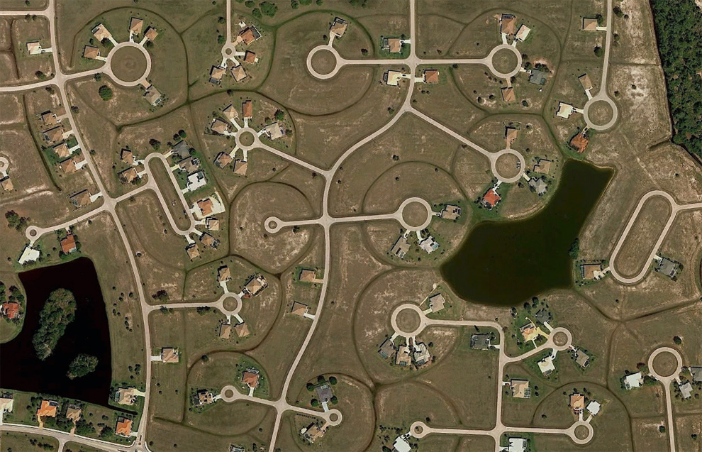
La imagen que tenéis al principio del post, por ejemplo, está tomada directamente de Google Maps y muestra una zona residencial construida alrededor de un lago artificial en la zona de Bonita Springs (Florida).
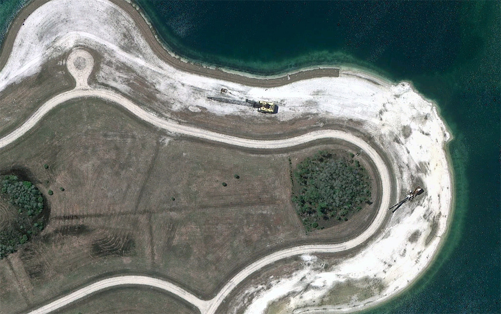
A section of a partially built residential project with only two houses in place, near Fort Myers, Florida. Map. (© Google)
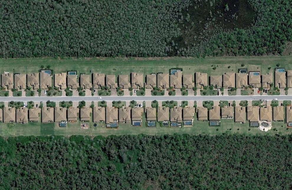
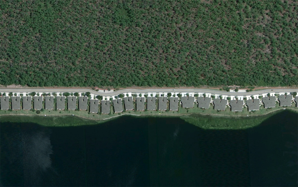
A strip of houses in a neighborhood southeast of Fort Myers, Florida. Map, Street View. (© Google) #
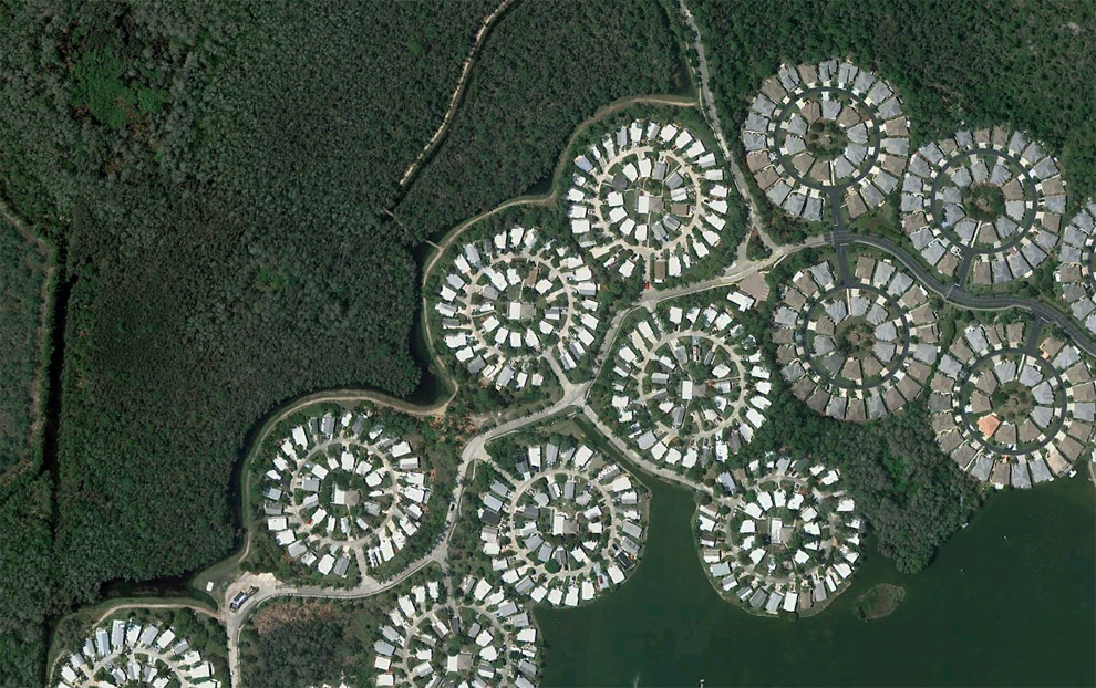
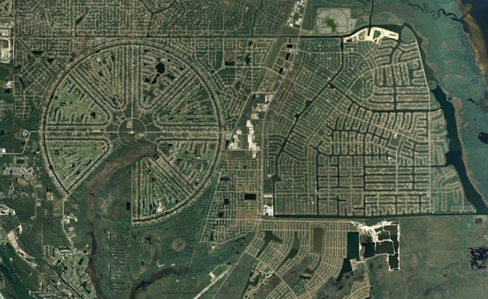
Circular layouts of homes near I-75, southwest of Fort Myers, Florida. Map. (© Google) #
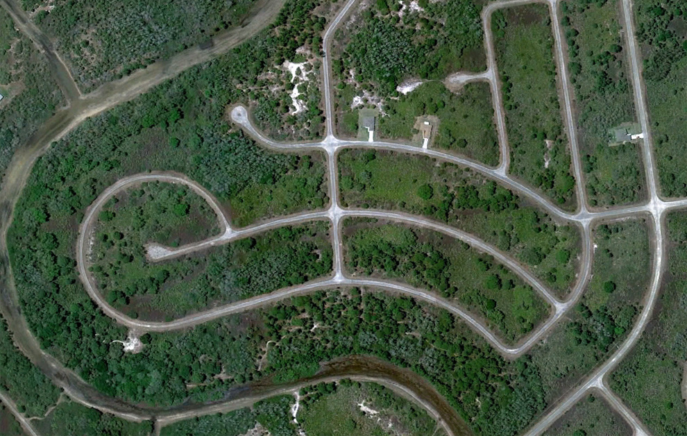
Once proposed as the 57,000 acre "Golden Gate Estates", this area was to be the largest subdivision in America in the 1960s. Many canals and roads were built, but the development eventually went bankrupt. Over the past 20 years or so, the land has been acquired by the state, and converted into the Picayune Strand State Forest. Map, Street View. (© Google/USGS) #
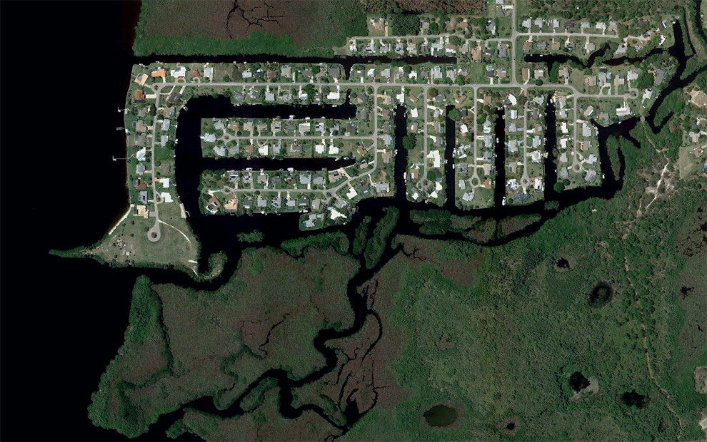
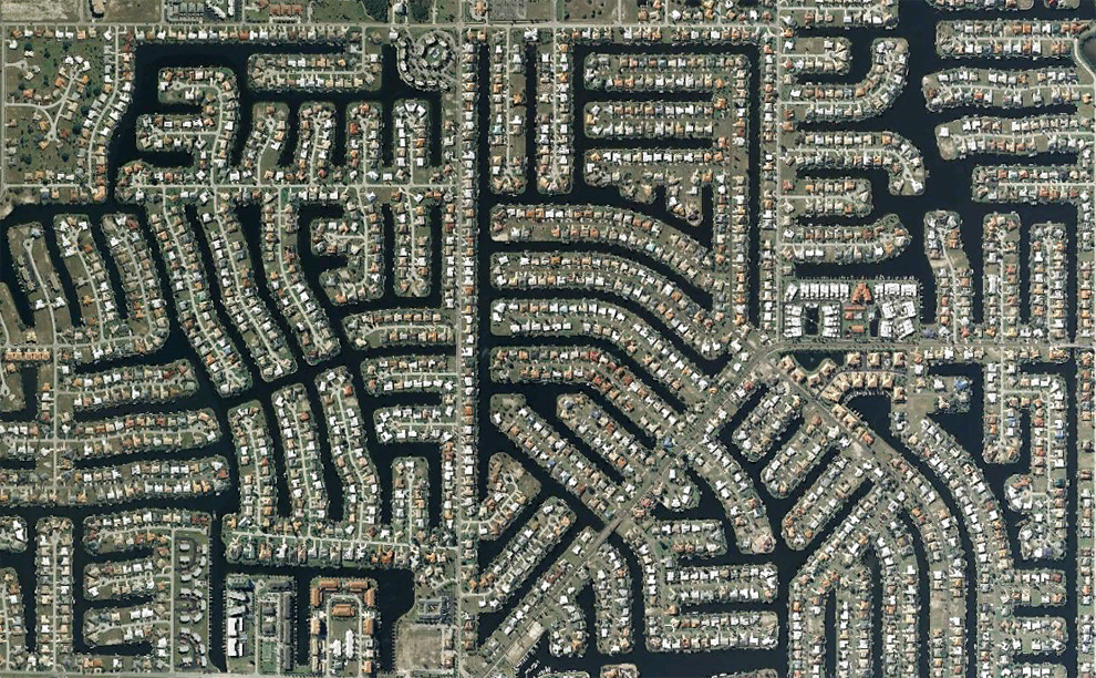
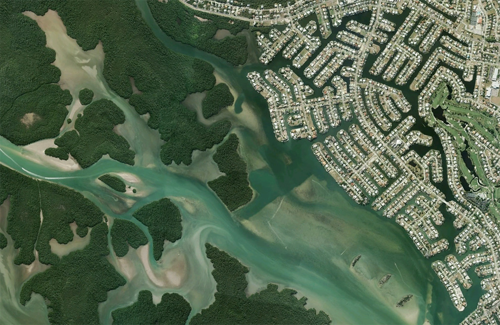
Boats make their way through canal structures in a neighborhood north of Cape Coral, Florida. Map, Street View. (© Google) #
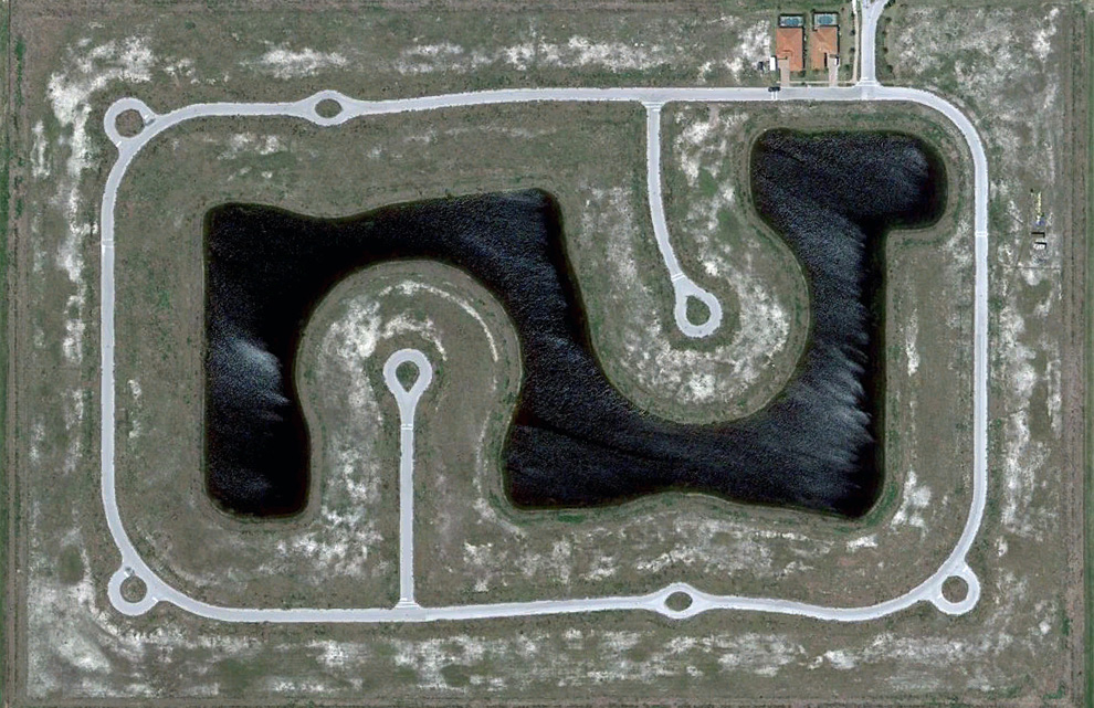
The Rotonda West neighborhood, originally developed in the 1960s, never quite fully completed, located in Charlotte County, Florida. Map, Street View. (© Google/Data SIO, NOAA, U.S. Navy, NGA, GEBCO) #
A densely built gated community in Bonita Springs, Florida. Map, Street View. (© Google) #
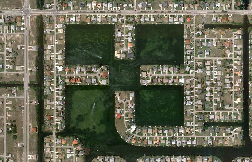
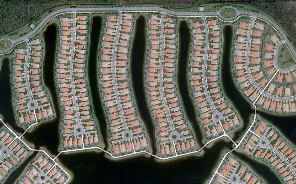
A community built around a man-made lake southeast of Bonita Springs, Florida. Map. (© Google) #
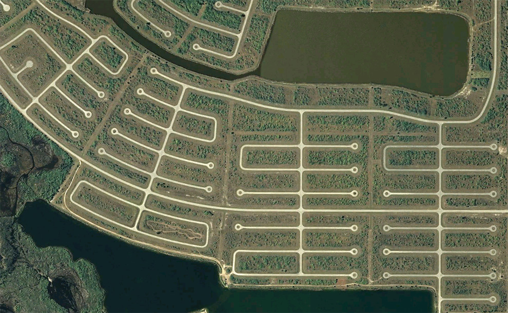
Empty cul-de-sacs fill an area south of Rotonda West in Charlotte County, Florida. Map, Street View. (© Google) #
A developed neighborhood and one under construction in Lehigh Acres, Florida. Map. (© Google) #
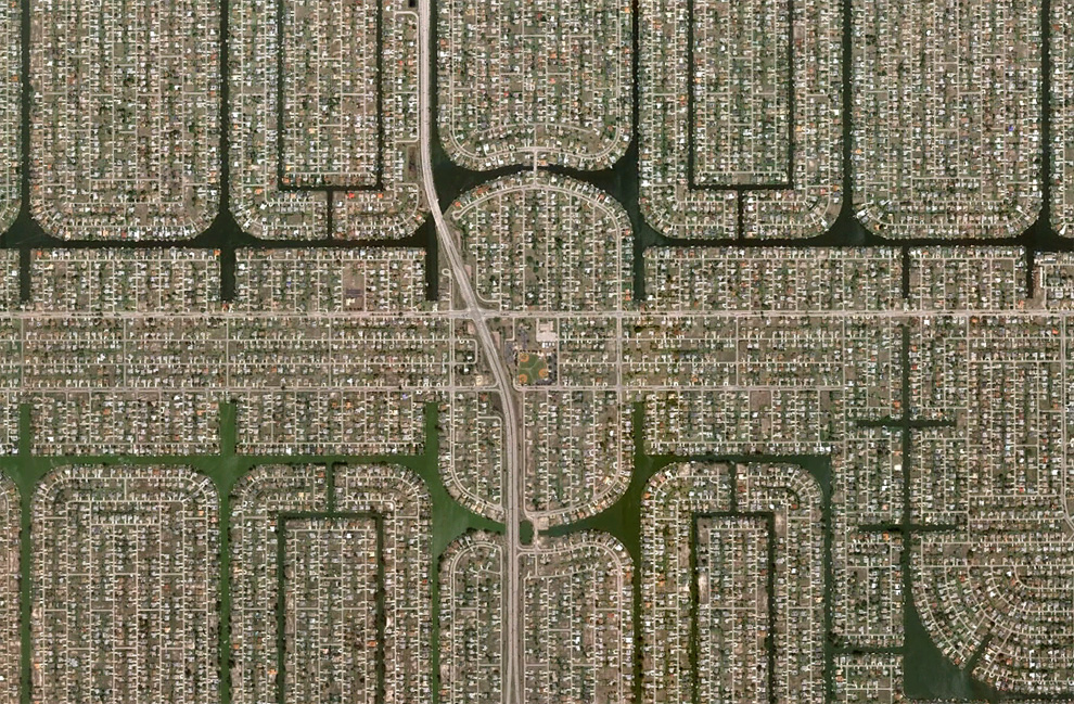
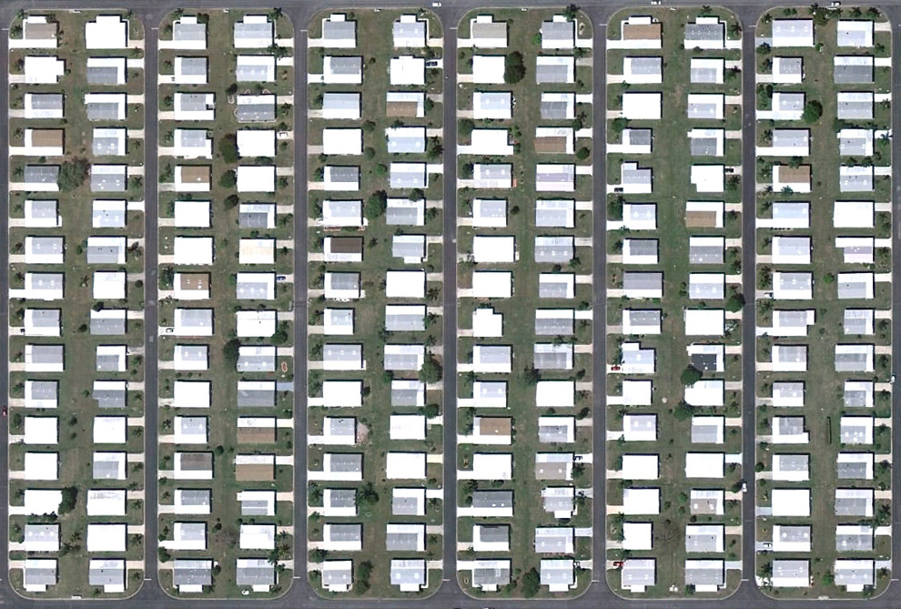
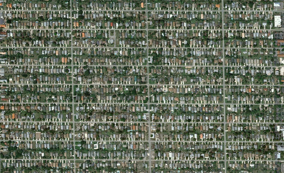
A densely populated neighborhood of Cape Coral, Florida. Map, Street View. (© Google) #
A development built near North Fort Myers Florida on the Caloosahatchee River. Map, Street View. (© Google/Europa Technologies) #
A partly developed, now partly overgrown neighborhood north of Lehigh Acres, Florida. Map, Street View. (© Google) #
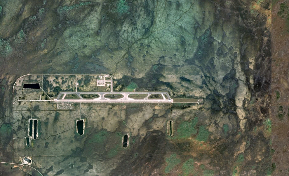
The Dade-Collier Training and Transition Airport was originally planned as the Everglades Jetport, and construction started in 1968 on what was to be the world's largest airport with six runways to support supersonic transport. Being surrounded by the Big Cypress National Preserve, environmental concerns halted construction, and when commercial supersonic transport didn't arrive, the project was left as-is, now a lightly-used airport. Map, Street View. (© Google/USGS/DigitalGlobe) #
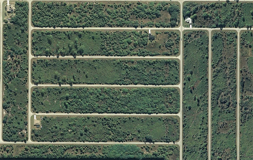
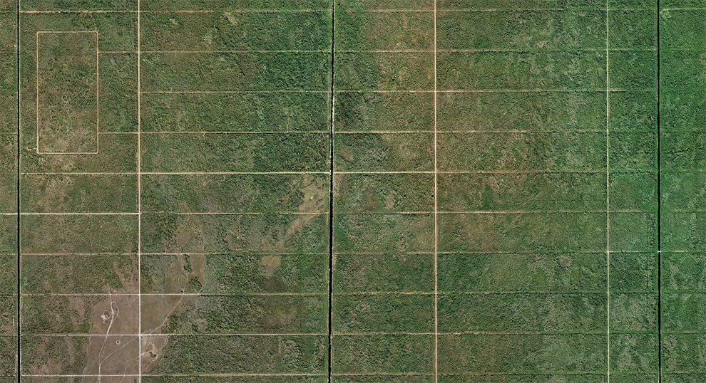
A grid of undeveloped avenues west of Port Charlotte, Florida. Map, Street View. (© Google) #
A neighborhood in Port Charlotte, Florida. Map. (© Google) #
A partially-developed community near Charlotte harbor, north of Fort Myers, Florida. Map, Street View. (© Google) #
Homes line a man-made lake shore near Naples, Florida. Map. (© Google) #
Canals and homes in Charlotte Park, south of Port Charlotte, Florida. Map, Street View. (© Google/Europa Technologies) #
A tightly developed parcel of land north of Englewood, Florida. Map, Street View. (© Google) #
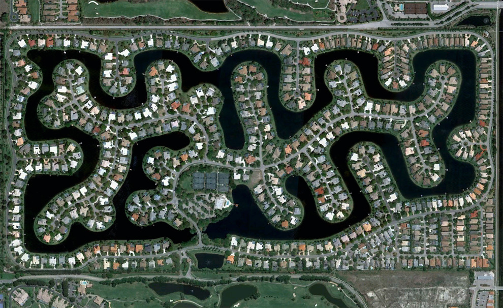
Part of Verona Walk, a gated community in Naples, Florida. Map. (© Google) #
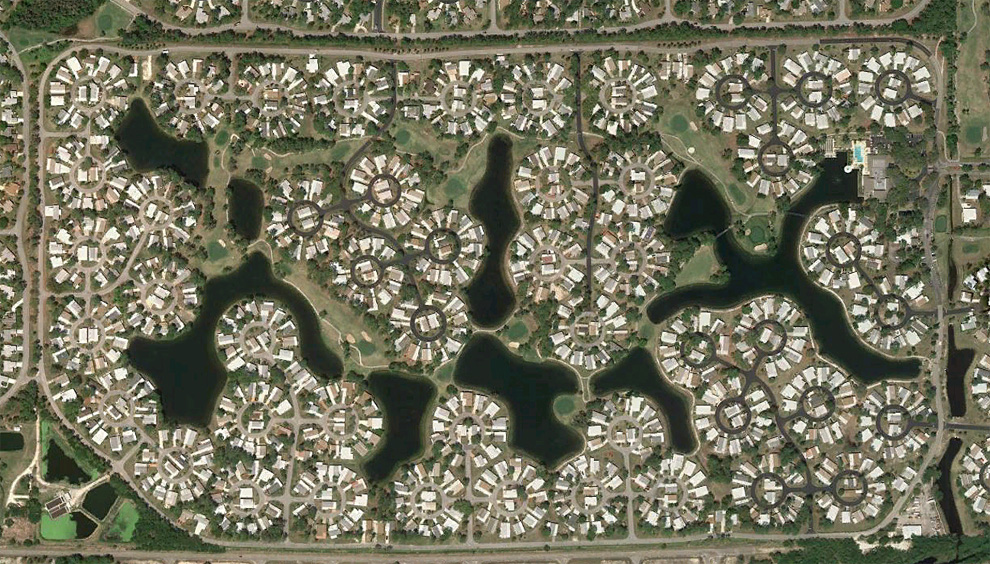
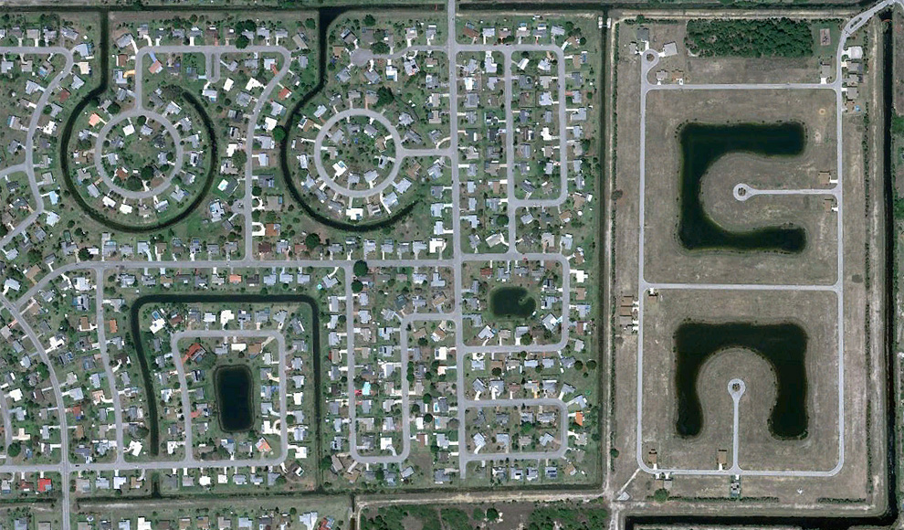
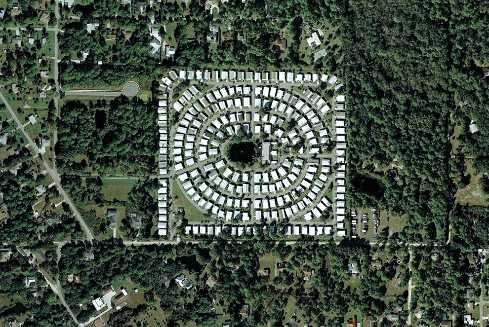
Homes laid out closely in circular arrangements north of North Fort Myers, Florida. Map. (© Google) #
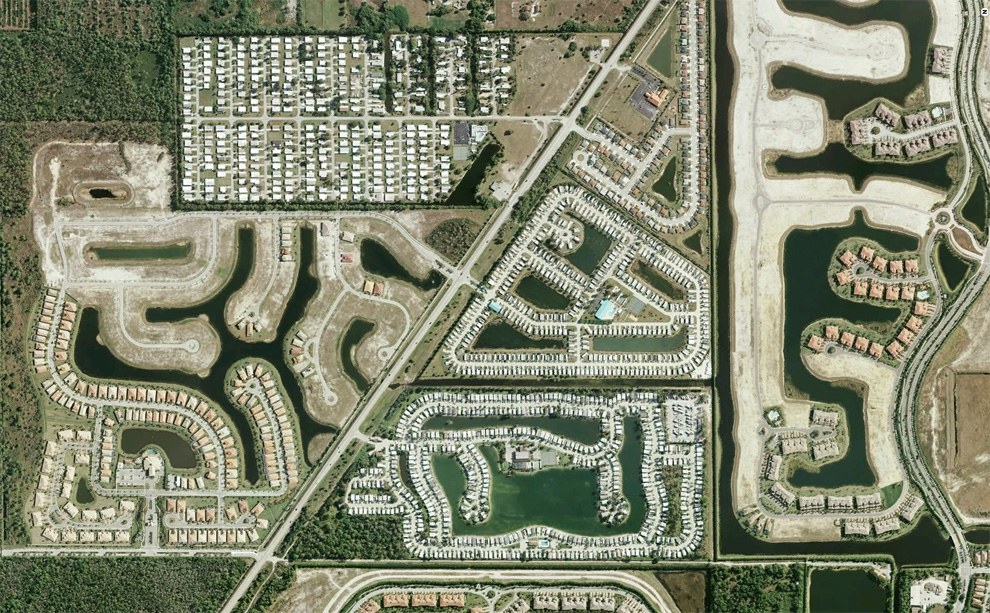
A series of residential developments in varying states of completion along a highway south of Naples, Florida. Map. (© Google/USGS) #
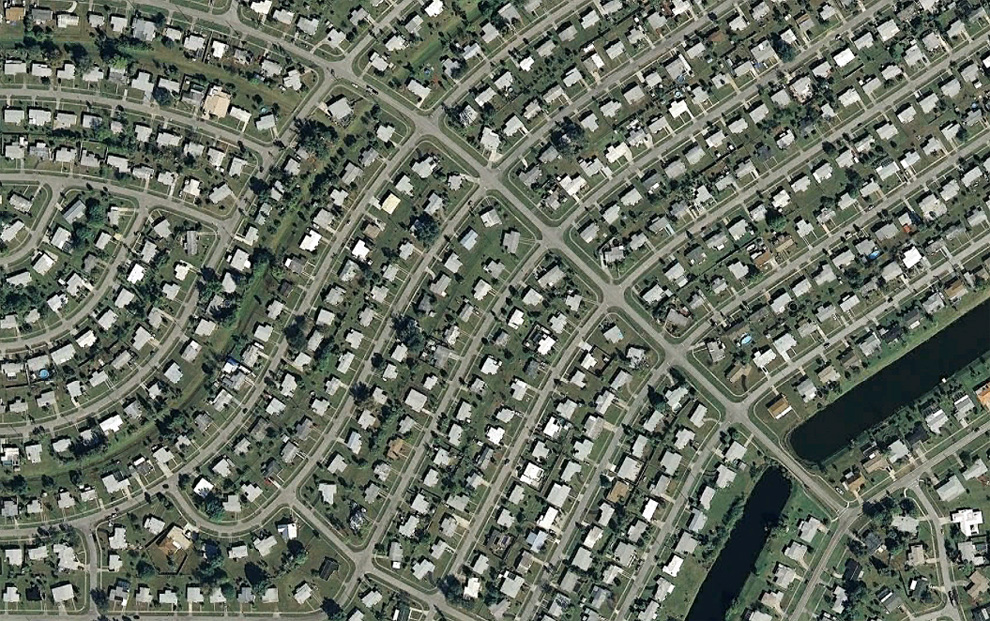
Naples Park, a densely developed community north of Naples, Florida. Map. (© Google) #
Canals and homes near Big Marco River on Marco Island, Florida. Map, Street View. (© Google/USGS) #
Fotografía aérea de paisajes humanos en Florida | Fotografia.com